Within Roxburghshire UFOs
Where Does Roxburghshire Fit in UFO Mapping?
Historic Roxburghshire matters because UFO records, newspapers and place names do not always match modern council maps.
On this page
- Historic county versus modern Borders
- Key towns and valleys in the sighting area
- How cross border geography complicates records
Page outline Jump by section
Introduction
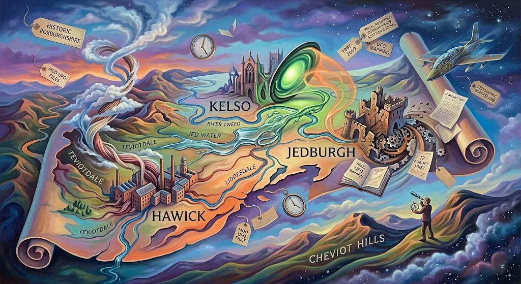
Roxburghshire’s place in UFO mapping is less about a famous local mystery and more about getting the geography right. Older reports, newspaper references and official lists may say “Roxburghshire”, while a modern reader may look for “Scottish Borders” and miss the historic county altogether. For this project, Roxburghshire means the historic inland Border county centred on Jedburgh, Hawick, Kelso, Teviotdale, Liddesdale and the Tweed-side settlements, not the whole modern Scottish Borders council area. That distinction matters because the clearest county-specific Ministry of Defence entry found so far is the Kelso report of 17 August 1997, and its location is recorded in historic county terms: “Kelso Roxburghshire”. [GOV.UK]assets.publishing.service.gov.ukufo report 1997ufo report 1997
Historic county versus modern Borders
Roxburghshire is one of the UK’s historic counties, the long-used geographical units that sit behind many older records, gazetteers and local identities. The Historic Counties Trust describes the Historic Counties Standard as a way of defining historic county names, areas and borders consistently for history, geography, heritage, record cataloguing and public presentation. [Historic Counties Trust]historiccountiestrust.co.ukOpen source on historiccountiestrust.co.uk. The Association of British Counties gives the wider UK frame: 92 historic counties, made up of 39 in England, 34 in Scotland, 13 in Wales and 6 in Northern Ireland. [Association of British Counties]abcounties.comOpen source on abcounties.com.
That is why the county layer used for this UFO project is not just decorative. The Wikimedia Commons/Wikishire historic-counties SVG is explicitly a map of the British Isles with counties as used before the late nineteenth-century local government reforms, and it is based on Wikishire source mapping. [Wikimedia Commons]commons.wikimedia.orgOpen source on wikimedia.org. In this UK collection, the Republic of Ireland appears only as surrounding geographic context on that broader map; it is not treated as part of the UK county set.
Modern administration is different. Today, Roxburghshire lies within the Scottish Borders council area, a larger authority that also includes territory historically associated with Berwickshire, Peeblesshire, Selkirkshire and a small part of Midlothian. The British Museum’s place scope note summarises that modern Scottish Borders includes areas once belonging to those older counties, including Roxburghshire. [British Museum]britishmuseum.orgOpen source on britishmuseum.org. For UFO records, that creates a practical problem: a report labelled “Scottish Borders” may not be Roxburghshire, while a report labelled “Roxburghshire” may not be easy to find if someone searches only modern council names.
The safe approach is to record both layers when possible: the historic county for project mapping, and the modern council area for present-day orientation. For example, “Kelso, Roxburghshire, now in Scottish Borders” tells the reader what the old report meant and where the place sits today. It also avoids accidentally folding Berwickshire, Selkirkshire or Peeblesshire material into the Roxburghshire branch.

The mapped county is a Border landscape, not a single town
Roxburghshire is an inland county shaped by valleys, hills and the Anglo-Scottish border. The Gazetteer of British Place Names describes it as stretching across the northern side of the Cheviot Hills, with much of the county occupied by Teviotdale and with the Teviot meeting the Tweed at Kelso. [Gazetteer of British Place Names]gazetteer.org.ukOpen source on gazetteer.org.uk. That physical pattern matters for UFO interpretation because many sightings are described from roads, valley towns, farms, hill edges and river corridors rather than from a single urban centre.
The key places for mapping are not interchangeable. Kelso sits by the meeting of the Teviot and Tweed; Hawick anchors Teviotdale; Jedburgh is the historic county town; Melrose and the Eildon area sit to the north; and Liddesdale forms the south-western part of the county. The same Gazetteer entry places Roxburgh’s destroyed town and castle near the narrow tongue of land between the Teviot and Tweed, while identifying Liddesdale in the south-west and the Cheviot border country to the east and south-east. [Gazetteer of British Place Names]gazetteer.org.ukOpen source on gazetteer.org.uk.
For UFO mapping, those details change how a report is read:
- Kelso and Tweedside are natural places for cross-county confusion because the Tweed runs eastwards towards Berwickshire and Northumberland.
- Hawick and Teviotdale point the eye along valley routes rather than to a single open plain.
- Jedburgh and the Jed Water area sit close enough to the English border for “Border” wording in a report to need careful checking.
- Liddesdale looks towards the western border country and can be confused with wider Border or Dumfriesshire references.
- The Cheviots form a real topographic boundary with Northumberland, but a light seen over a ridge may be reported from either side depending on where the witness stood.
This does not make any sighting stronger or weaker on its own. It simply means that “where?” is not a minor detail. A report from “near Kelso”, “in the Borders”, “over the Cheviots” or “towards Northumberland” needs a map before it can be counted as a Roxburghshire case.
Why the Kelso entry is the fixed point
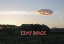
The most useful county-specific anchor is still the Ministry of Defence’s 1997 listing. GOV.UK describes the released UFO reports as covering dates, times, locations and brief sighting descriptions from 1997 to 2009. [GOV.UK]GOV.UKUF O reports in the UKUF O reports in the UK In that list, the 17 August 1997 entry gives “Kelso Roxburghshire” at 02:30 and describes “an oval object” with a green light in the centre, an orange glow, a rushing wind sound and speed “faster than a jet”. [GOV.UK]assets.publishing.service.gov.ukufo report 1997ufo report 1997
For this particular subtopic, the value of the Kelso entry is geographic as much as evidential. It shows how a national UK UFO dataset can preserve an older county label. A modern administrative search for Scottish Borders might find it, but the original wording ties the case to Roxburghshire. That makes Kelso the county’s cleanest example of why historic county mapping is not a nostalgic extra; it changes what is counted and where it is filed.
The same entry also shows the limits of the record. The MoD list gives no witness name, no direction of travel, no weather, no duration, no angular height, no radar track and no conclusion. It is a record of a reported sighting, not a finding that an extraordinary object was present. Its usefulness is that it fixes one reported event to a named place, date, time and historic county.

Cross-border geography complicates UFO records
Roxburghshire’s border position means that UFO material can easily spill across labels. The county borders Northumberland and Cumberland on the English side and sits beside Dumfriesshire, Selkirkshire, Midlothian and Berwickshire on the Scottish side. Modern Scottish Borders usage then overlays several older counties with one council identity. A sighting described in a newspaper as “in the Borders” may therefore be too broad for county-level mapping unless the place name is given.
This is especially important for sky sightings because the object’s apparent position and the witness’s location may not be the same. A witness in Kelso might report a light towards Northumberland. A witness near the Cheviots might describe something “over the border”. A report from Hawick could involve a sound or aircraft-like light following a valley route rather than an object directly over the town. County mapping should normally use the witness location as the primary anchor, while noting the reported direction of the object when the source gives it.
The aviation layer also matters. GOV.UK’s RAF operational low-flying timetable identifies LFA 20(T) as covering “the borders of southern Scotland and northern England”, one of three tactical training areas used for operational low-flying training timetables. [GOV.UK]GOV.UKMilitary low flying: RAF operational low flying training timetableMilitary low flying: RAF operational low flying training timetable That does not explain the Kelso report by itself, and it should not be used as a blanket debunking tool. But it does mean that low-flying military aircraft, aircraft noise, sudden lights and fast apparent motion are part of the normal interpretive background for Border sky reports.
The point is not that every Border UFO was an aircraft. It is that the region’s geography makes aircraft explanations more plausible in some cases and harder to rule out without detail. A strong report would need information such as exact viewing direction, duration, sound, height estimate, weather, whether other witnesses saw the same thing, and whether aircraft activity was known at the time.
Archives, newspapers and place names need double-checking
Roxburghshire research should not rely only on modern search terms. Scotland’s People lists Roxburgh county material through Ordnance Survey Name Books covering parishes and towns such as Ancrum, Castleton, Hawick, Jedburgh, Kelso, Melrose, Roxburgh, St Boswells, Teviothead, Wilton and Yetholm. [Scotland's People]scotlandspeople.gov.ukScotland's People Records for Roxburgh county | Scotland's PeopleScotland's People Records for Roxburgh county | Scotland's People Those names are useful because older records may identify a parish, burgh, valley or rural locality rather than a modern council area.
Local newspapers add another layer. The British Newspaper Archive’s Borders, Scotland index includes substantial runs for titles such as the Southern Reporter, Jedburgh Gazette, Teviotdale Record and Jedburgh Advertiser, Kelso Chronicle and Hawick Express. [British Newspaper Archive]britishnewspaperarchive.co.ukOpen source on britishnewspaperarchive.co.uk. For UFO history, those papers are exactly the sort of places where short local reports, letters, police mentions or “mystery light” items might appear. But newspaper geography can be loose: a “Border” story might be local to Roxburghshire, or it might belong to Berwickshire, Selkirkshire, Peeblesshire, Northumberland or Dumfriesshire.
A sensible Roxburghshire filing test is therefore:
- Start with the witness location, not the object’s apparent direction.
- Translate the place name into historic county geography before assigning it to Roxburghshire.
- Record modern Scottish Borders only as a present-day orientation, not as a replacement for the historic county.
- Flag cross-border reports clearly when the witness, object direction, newspaper market and official record point to different places.
- Avoid counting vague “Borders” reports as Roxburghshire unless a town, parish, road, valley or map reference supports it.
This method is deliberately cautious. It may leave some sightings unassigned or only tentatively assigned, but it prevents the Roxburghshire page from absorbing every unexplained light reported somewhere in the modern Scottish Borders.

What the map changes for readers
The main takeaway is that Roxburghshire’s UFO history is thin but geographically instructive. The Kelso entry is a modest official record, not a dramatic solved or unsolved classic. Its importance is that it demonstrates why county mapping needs precision: the same place can be historic Roxburghshire, modern Scottish Borders, part of a Border media area, and close to English counties across the hills.
That makes this page a guide to reading the county’s evidence rather than a catalogue of spectacular cases. A strong Roxburghshire case should be tied to a specific place such as Kelso, Hawick, Jedburgh, Melrose, Liddesdale or Teviotdale, checked against historic county boundaries, and then interpreted in light of Border terrain, low-flying aviation context, local newspaper coverage and the limitations of official UFO lists. Without that geographic discipline, the county’s sparse record becomes either artificially empty or artificially inflated.
Amazon book picks
Further Reading
Books and field guides related to Where Does Roxburghshire Fit in UFO Mapping?. Use these as the next step if you want deeper reading beyond the article.
The UFO Experience
Useful for understanding how sighting databases and classifications are built.
The Unidentified
Directly relevant to how places and regions become associated with unexplained reports.
The Lore of Scotland
Adds geographic and cultural context to how unusual reports become local legends.
eBay marketplace picks
Marketplace Samples
Example marketplace items related to this page. Use the search link to explore similar finds on eBay.
Endnotes
-
Source: assets.publishing.service.gov.uk
Title: ufo report 1997
Link: https://assets.publishing.service.gov.uk/media/5a758d2fe5274a6faebebd11/ufo_report_1997.pdf -
Source: commons.wikimedia.org
Link: https://commons.wikimedia.org/wiki/File%3ABritish_Isles_map_showing_UK%2C_Republic_of_Ireland%2C_and_historic_counties.svg -
Source: GOV.UK
Title: UF O reports in the UK
Link: https://www.gov.uk/government/publications/ufo-reports-in-the-uk -
Source: GOV.UK
Title: Military low flying: RAF operational low flying training timetable
Link: https://www.gov.uk/government/publications/military-low-flying-raf-operational-low-flying-training-timetable -
Source: scotlandspeople.gov.uk
Title: Scotland’s People Records for Roxburgh county | Scotland’s People
Link: https://www.scotlandspeople.gov.uk/place-page/Roxburgh%20county/GAZ00029/-/REX01692 -
Source: nationalarchives.gov.uk
Link: https://www.nationalarchives.gov.uk/help-with-your-research/research-guides/ufos/ -
Source: nationalarchives.gov.uk
Link: https://www.nationalarchives.gov.uk/explore-the-collection/explore-by-time-period/postwar/ufo-reports/ -
Source: cdn.nationalarchives.gov.uk
Link: https://cdn.nationalarchives.gov.uk/documents/the-ufo-files-extract.pdf -
Source: nationalarchives.gov.uk
Link: https://www.nationalarchives.gov.uk/search/results/?_q=ufo -
Source: discovery.nationalarchives.gov.uk
Link: https://discovery.nationalarchives.gov.uk/details/a/A13530549 -
Source: cdn.nationalarchives.gov.uk
Title: ufo research guide 2013
Link: https://cdn.nationalarchives.gov.uk/documents/ufo-research-guide-2013.pdf -
Source: cdn.nationalarchives.gov.uk
Link: https://cdn.nationalarchives.gov.uk/documents/aug-2011-research-guide.pdf -
Source: discovery.nationalarchives.gov.uk
Link: https://discovery.nationalarchives.gov.uk/details/r/C13442640 -
Source: nationalarchives.gov.uk
Link: https://www.nationalarchives.gov.uk/help-with-your-research/research-guides/foreign-commonwealth-correspondence-and-records-from-1782/ -
Source: cdn.nationalarchives.gov.uk
Title: ufo highlights guide 2013
Link: https://cdn.nationalarchives.gov.uk/documents/ufo-highlights-guide-2013.pdf -
Source: nationalarchives.gov.uk
Title: new-chat Archives
Link: https://www.nationalarchives.gov.uk/category/new-chat/ -
Source: cdn.nationalarchives.gov.uk
Link: https://cdn.nationalarchives.gov.uk/documents/final-tranche-of-UFO-files-released.pdf -
Source: nationalarchives.gov.uk
Title: Help with your research Archives
Link: https://www.nationalarchives.gov.uk/category/records-2/page/4/ -
Source: nationalarchives.gov.uk
Link: https://www.nationalarchives.gov.uk/category/records-2/page/17/ -
Source: cdn.nationalarchives.gov.uk
Link: https://cdn.nationalarchives.gov.uk/documents/ufo-video-transcript.pdf -
Source: nationalarchives.gov.uk
Title: Help with your research Archives
Link: https://www.nationalarchives.gov.uk/category/records-2/page/15/ -
Source: nationalarchives.gov.uk
Title: Help with your research Archives
Link: https://www.nationalarchives.gov.uk/category/records-2/page/25/ -
Source: cdn.nationalarchives.gov.uk
Title: may 2008 disclosure log
Link: https://cdn.nationalarchives.gov.uk/documents/may-2008-disclosure-log.pdf
Published: may 2008 -
Source: nationalarchives.gov.uk
Title: Help with your research Archives
Link: https://www.nationalarchives.gov.uk/category/records-2/page/10/ -
Source: nationalarchives.gov.uk
Title: Help with your research Archives
Link: https://www.nationalarchives.gov.uk/category/records-2/page/21/ -
Source: nationalarchives.gov.uk
Link: https://www.nationalarchives.gov.uk/help-with-your-research/research-guides/intelligence-and-security-services/ -
Source: commons.wikimedia.org
Title: File:Ross shire British Isles.svg
Link: https://commons.wikimedia.org/wiki/File%3ARoss-shire_-_British_Isles.svg -
Source: commons.wikimedia.org
Title: Category:SVG maps of the British Isles
Link: https://commons.wikimedia.org/wiki/Category%3ASVG_maps_of_the_British_Isles -
Source: commons.wikimedia.org
Title: Category:SVG maps of historic counties of the United Kingdom
Link: https://commons.wikimedia.org/wiki/Category%3ASVG_maps_of_historic_counties_of_the_United_Kingdom -
Source: commons.wikimedia.org
Title: Category:SVG maps of the United Kingdom
Link: https://commons.wikimedia.org/wiki/Category%3ASVG_maps_of_the_United_Kingdom -
Source: commons.wikimedia.org
Title: File:Anglesey British Isles.svg
Link: https://commons.wikimedia.org/wiki/File%3AAnglesey_-_British_Isles.svg -
Source: raf.mod.uk
Link: https://www.raf.mod.uk/our-organisation/stations/raf-lossiemouth/flying-info/ -
Source: data.gov.uk
Title: Historic County Borders
Link: https://www.data.gov.uk/dataset/a0cb00e3-00d4-4b87-9a7b-95bcb8d0d87c/historic-county-borders -
Source: archives.gov
Link: https://www.archives.gov/research/topics/uaps -
Source: boundaries.scot
Title: Local government Scotland before 1975 1758892795
Link: https://www.boundaries.scot/wp-content/uploads/2025/09/Local_government_Scotland_before_1975_1758892795.pdf -
Source: archive.org
Link: https://archive.org/stream/glasgownatu2319962001ande/glasgownatu2319962001ande_djvu.txt -
Source: gazetteer.org.uk
Link: https://gazetteer.org.uk/place/Roxburghshire -
Source: historiccountiestrust.co.uk
Link: https://historiccountiestrust.co.uk/standard -
Source: abcounties.com
Link: https://abcounties.com/introduction/ -
Source: britishmuseum.org
Link: https://www.britishmuseum.org/collection/term/x38622 -
Source: britishnewspaperarchive.co.uk
Link: https://www.britishnewspaperarchive.co.uk/search/results?region=borders%2C+scotland&retrievecountrycounts=false&sortorder=dayearly -
Source: Wikipedia
Link: https://en.wikipedia.org/wiki/Roxburghshire -
Source: Wikipedia
Title: Scottish Borders
Link: https://en.wikipedia.org/wiki/Scottish_Borders -
Source: gazetteer.org.uk
Link: https://gazetteer.org.uk/place/Ross-shire -
Source: gazetteer.org.uk
Link: https://gazetteer.org.uk/place/Lochgoilhead%2C_Argyllshire_27798 -
Source: gazetteer.org.uk
Link: https://gazetteer.org.uk/place/Arrochar%2C_Dunbartonshire_1249 -
Source: gazetteer.org.uk
Title: ABC Fact Sheet Historic Counties
Link: https://gazetteer.org.uk/ABC_Fact_Sheet_Historic_Counties_Introduction.pdf -
Source: abcounties.com
Link: https://abcounties.com/counties/county-profiles/roxburghshire/ -
Source: abcounties.com
Title: historic counties wall map now available
Link: https://abcounties.com/news/historic-counties-wall-map-now-available/ -
Source: wikishire.co.uk
Link: https://wikishire.co.uk/wiki/Dumfriesshire -
Source: wikishire.co.uk
Title: Historic Counties Standard
Link: https://wikishire.co.uk/wiki/Historic_Counties_Standard -
Source: wikishire.co.uk
Link: https://wikishire.co.uk/wiki/Roxburghshire -
Source: historiccountiestrust.co.uk
Link: https://historiccountiestrust.co.uk/ -
Source: facebook.com
Link: https://www.facebook.com/HistoricCounties/ -
Source: realcounties.com
Title: historic counties standard
Link: https://realcounties.com/wp-content/uploads/2023/10/historic_counties_standard.pdf -
Source: kids.kiddle.co
Title: Scottish Borders
Link: https://kids.kiddle.co/Scottish_Borders -
Source: rainycity.blog
Title: Scottish Borders
Link: https://rainycity.blog/out-about/scottish-borders-things-to-do-part-3-selkirk-hawick-and-jedburgh/ -
Source: visitscotland.com
Title: The Scottish Borders
Link: https://www.visitscotland.com/places-to-go/scottish-borders
Additional References
-
Source: youtube.com
Title: Ed Miller
Link: http://www.youtube.com/watch?v=e5dBI_-1zCISource snippet
The Complete History of the British Isles, Summarized...
-
Source: youtube.com
Title: What’s With That Big Line Across Scotland?
Link: http://www.youtube.com/watch?v=DFUbtPq1CIkSource snippet
History of UK county boundaries and geography explained English counties explained Map Men...
-
Source: youtube.com
Title: The Entire History of Scotland
Link: http://www.youtube.com/watch?v=_PhX3dvmgkoSource snippet
Ed Miller - "The Scottish Borders - History, Songs, and Lots of Bonnie Pictures"...
-
Source: banthebomb.org
Link: https://www.banthebomb.org/militaryscotland/appendixc.html -
Source: bemersydeestate.com
Link: https://bemersydeestate.com/bemersyde-history/border-reivers/ -
Source: planbee.com
Link: https://planbee.com/pages/counties-of-the-uk?srsltid=AfmBOoq4EVDBHxAsX1LleHf4oy75J_ZqQpQ8TMPMJO3mrkrI6cw3clmu -
Source: facebook.com
Link: https://www.facebook.com/adafruitindustries/posts/declassified-drawings-from-the-british-governments-ufo-desk/10156001362427578/ -
Source: archiuk.com
Link: https://www.archiuk.com/cgi-bin/build_nls_historic_map.pl?is_sub=&latitude=57.752806&longitude=-4.387118&map_location=IV17+0YQ+IV170YQ+in+Alness&os_series=7&postcode=IV17+0YQ&pwd=&search_location=IV17+0YQ%2C+IV170YQ+in+Alness%2C+Highland%2C+Ross-shire%2C+Wales -
Source: facebook.com
Link: https://www.facebook.com/thenationalnewspaperscotland/posts/did-this-scot-really-have-a-close-encounter-with-a-ufo-/3241773246112694/ -
Source: gbmaps.com
Link: https://www.gbmaps.com/free-county-maps/Dunbartonshire.php
Topic Tree