Within Aberdeenshire UFOs
Which Aberdeenshire Counts for UFO History?
Aberdeenshire UFO records can shift meaning when Aberdeen, Muchalls, Kincardineshire and modern council areas are mixed together.
On this page
- Historic county versus modern council area
- Aberdeen, Muchalls and border cases
- How boundary choices affect sighting maps
Page outline Jump by section
Introduction
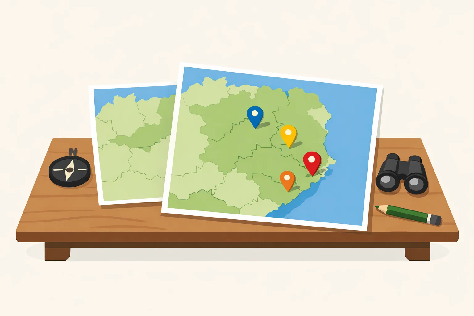
Aberdeenshire UFO history is harder to map than it first appears because “Aberdeenshire” can mean at least three different things: the historic County of Aberdeen, the modern Aberdeenshire council area, or the looser north-east reporting area used by newspapers, witnesses and some UFO writers. For this project, the main map anchor is the historic county, not the post-1996 council boundary. That choice matters because it changes how readers understand Aberdeen city reports, Muchalls stories, coastal sightings near the old Kincardineshire line, and Ministry of Defence entries that use broad county labels rather than careful historic geography. The safest approach is not to force every sighting into one neat box, but to state which boundary is being used and flag border cases plainly. The aim is a cleaner UFO map, not a more dramatic one.
Historic county or modern council area?
The historic county used by this project follows the wider UK historic-counties frame: 92 historic counties across the UK, including 34 in Scotland, 39 in England, 13 in Wales and 6 in Northern Ireland. The Wikimedia Commons historic-counties SVG lists Aberdeenshire as one of those mapped counties, and the Historic County Borders Project describes its digitised historic-county borders as freely available geographic data. [Wikimedia Commons+2county-borders.co.uk]commons.wikimedia.orgWikimedia CommonsFile:Historic counties of the United Kingdom.svgFile:Historic counties of the United Kingdom.svg · 1 Aberdeenshire · 2 A…
That is not the same thing as the modern Aberdeenshire council area. Modern Aberdeenshire was created as one of Scotland’s 32 council areas in 1996 and has boundaries that differ substantially from the historic county: it includes much of historic Kincardineshire and part of Banffshire, while Aberdeen City is a separate council area. [Wikipedia]WikipediaOpen source on wikipedia.org. For UFO mapping, this means a modern “Aberdeenshire” dataset can quietly pull in places that are not historic Aberdeenshire, while excluding Aberdeen city even though Aberdeen was historically central to the county’s identity and regional reporting.
The historic County of Aberdeen also has a distinctive geography of its own. Wikishire describes it as bordering Kincardineshire, Angus and Perthshire to the south, Inverness-shire and Banffshire to the west, and the North Sea to the north and east, with about 65 miles of coastline. [Wikishire]wikishire.co.ukOpen source on wikishire.co.uk. That coastal and upland spread helps explain why UFO reports from the area often involve lights over open country, sea-facing horizons, oil and helicopter traffic, or ambiguous sightings around Aberdeen’s urban fringe.
The boundary choice therefore affects both inclusion and interpretation. A sighting logged as “Aberdeen, Aberdeenshire” in a Ministry of Defence table can be historically relevant to Aberdeenshire even if a modern council map would place Aberdeen outside Aberdeenshire Council. A sighting at Muchalls, by contrast, may look like an Aberdeenshire item in modern media but sits in historic Kincardineshire. The mapping decision is not just clerical; it changes the shape of the local UFO story.

Aberdeen, Muchalls and the awkward border cases
Aberdeen is the first mapping problem. In everyday speech, it is often treated as the centre of the north-east, and older county language ties it closely to Aberdeenshire. In modern local government, however, Aberdeen City is separate from Aberdeenshire Council. That distinction is easy to miss when reading UFO material because MoD tables, press stories and witness accounts often use place names more casually than a historical gazetteer would.
The MoD’s published UFO report tables show why this matters. GOV.UK describes the 1997–2009 UFO reports as records giving the date, time, location and brief description of sightings. [GOV.UK]GOV.UKufo reports in the ukufo reports in the uk In 1997, one entry recorded “Aberdeen” in “Aberdeenshire” and described four bright, roundish white lights moving in a small circle before rotating clockwise. [GOV.UK]assets.publishing.service.gov.ukufo report 1997ufo report 1997 In 2007, another entry gave “Bridge of Don/Aberdeen” in “Aberdeenshire” and described lights forming two bright triangle formations. [GOV.UK]assets.publishing.service.gov.ukufo report 2007ufo report 2007 In 2008, an Aberdeen entry simply recorded “strange lights in the sky”. [GOV.UK]assets.publishing.service.gov.ukufo report 2008ufo report 2008
A modern council-only map could treat those as Aberdeen City rather than Aberdeenshire. A historic-county UFO map should not erase them automatically, because Aberdeen is part of the older county story and is a major reference point for witnesses, newspapers and aviation geography. The cleanest labelling would be: “Aberdeen area — historic Aberdeenshire context; modern Aberdeen City council area.” That tells readers why the entry appears without pretending the current council boundary says the same thing.
Muchalls is the opposite kind of problem. Recent media coverage has described Muchalls as an Aberdeenshire UFO “hotspot” or “window area”, drawing on claims by Scottish UFO writer Malcolm Robinson and stories said to date back to the 1960s and 1970s. [Mirror]mirror.co.ukuk village known ufo hotspot 31026114uk village known ufo hotspot 31026114 But geographically, Muchalls is usually described as a small coastal village in Kincardineshire, south of Newtonhill and north of Stonehaven, even though it now sits within the Aberdeenshire council area. [Wikipedia]WikipediaOpen source on wikipedia.org.
That does not make the Muchalls stories irrelevant. They belong in the north-east UFO picture and may deserve cross-linking from an Aberdeenshire page because they are repeatedly marketed to readers as “Aberdeenshire” cases. But they should not be silently counted as historic Aberdeenshire evidence. A careful map would tag Muchalls as: “modern Aberdeenshire council area; historic Kincardineshire; north-east Scotland UFO context.” That one line prevents a misleading cluster from appearing inside the historic County of Aberdeen.
How boundary choices change sighting maps
A UFO map can look more convincing than the underlying evidence deserves. Dots on a county map imply pattern, but the pattern may partly be an artefact of boundary choice, reporting habits or database design. Aberdeenshire is a good example because several kinds of boundary drift can happen at once.
First, there is administrative drift. Modern Aberdeenshire includes areas that historic-county mapping would place in Kincardineshire or Banffshire, while excluding Aberdeen City. If a map uses council boundaries but calls the result “historic Aberdeenshire”, it will overcount some southern and northern cases and under-explain Aberdeen city reports.
Second, there is source drift. The MoD tables are valuable because they preserve official report entries, but they are short logs rather than full investigations. The National Archives’ UFO research guide says surviving UFO records include policy papers, Parliamentary material, correspondence with the public and sighting reports; it does not present those reports as proof of unusual craft. [The National Archives]nationalarchives.gov.ukOpen source on nationalarchives.gov.uk. For Aberdeenshire, that means a logged sighting should be treated as evidence that a report was made, not as confirmation that an extraordinary object was present.
Third, there is media drift. Local and national articles may use familiar modern labels because those are clearer to contemporary readers. That can be useful for public communication, but it can also blur historic geography. A headline calling Muchalls an Aberdeenshire UFO hotspot may be understandable in council-area terms, but it is not precise enough for a historic-county index. [Mirror]mirror.co.ukuk village known ufo hotspot 31026114uk village known ufo hotspot 31026114
Fourth, there is sky-geography drift. Witnesses report what they saw from a place, not always where the object actually was. A light seen from Portlethen, Bridge of Don or Ballater may have been above another district, over the North Sea, on an aircraft route, or far beyond the county line. The 2009 Portlethen entry, for example, described “a big yellow glow in the sky to the south of Aberdeen” at about 2,500 feet and specifically said it was not aircraft landing lights. [GOV.UK]assets.publishing.service.gov.ukufo report 2009ufo report 2009 The report belongs in the local record, but the object’s true position cannot be fixed from the brief table wording alone.
The result is that Aberdeenshire UFO mapping should not be a simple count of dots. It should be a layered reading of place, boundary, report source and uncertainty.

A practical mapping rule for Aberdeenshire cases
The best way to map Aberdeenshire UFO material is to separate the sighting’s reported place from the county interpretation. That keeps the public-facing map readable while protecting readers from false precision.
A useful entry should record:
- Reported location: the place name used by the witness, MoD table, newspaper or investigator.
- Historic county: whether the place falls inside historic Aberdeenshire or a neighbouring historic county such as Kincardineshire or Banffshire.
- Modern council area: whether the place now sits in Aberdeenshire Council, Aberdeen City or another authority.
- Source wording: the exact or near-exact geographic label used by the source, especially where it says “Aberdeen, Aberdeenshire” or “Muchalls, Aberdeenshire”.
- Confidence level: whether the location is precise, approximate, regional, or ambiguous.
- Cross-branch note: whether the case should also appear under Aberdeen City, Kincardineshire, Banffshire, aviation, MoD records, or north-east Scotland sighting clusters.
This matters most for cases that readers are likely to remember. The 1999 Ballater report, which described two glitter-ball-like objects with blue, red and green lights, sits comfortably within Aberdeenshire’s historic-county frame. [GOV.UK]assets.publishing.service.gov.ukOpen source on service.gov.uk. The 1998 Ladysbridge report, logged by the MoD as Aberdeenshire and describing a slow-moving orange object with an intense bright light, needs more care because local and historic county associations around Banffshire can complicate how readers place it. [GOV.UK]assets.publishing.service.gov.ukOpen source on service.gov.uk. Muchalls needs still more care because its modern and historic labels point in different directions.
The payoff is not pedantry. It helps readers distinguish a genuine local pattern from a map-making artefact. If several reports cluster around Aberdeen, that may say something about population density, airport visibility, press access or skywatching from an urban edge. If a cluster appears around Muchalls only after modern council boundaries are used, the correct interpretation may be “north-east coastal folklore and Kincardineshire-border reporting”, not “historic Aberdeenshire hotspot”.
What this means for the Aberdeenshire UFO record
Using historic Aberdeenshire as the centre of gravity produces a more disciplined UFO history. It keeps the county page from becoming a catch-all for every north-east Scottish sighting, but it also avoids the opposite mistake of excluding Aberdeen-related records just because modern local government has redrawn the map.
The strongest boundary-sensitive lesson is that Aberdeenshire’s UFO record is mixed rather than singular. Official MoD entries give a run of reportable incidents around Aberdeen, Ballater, Portlethen and other named places, but the tables are brief and rarely include the checks needed to resolve them. [GOV.UK]GOV.UKufo reports in the ukufo reports in the uk Media and UFO-literature claims add colour, especially around Muchalls, but those claims often need extra geographic labelling before they can be used responsibly on a historic-county map. [Mirror]mirror.co.ukuk village known ufo hotspot 31026114uk village known ufo hotspot 31026114
The right reader takeaway is simple: ask “which Aberdeenshire?” before asking “how many sightings?” A modern council map, a historic-county map and a north-east media map will not produce the same answer. For UFO history, where evidence is often brief, anecdotal or loosely reported, that difference can decide whether a case looks central, marginal, duplicated or misplaced.

Amazon book picks
Further Reading
Books and field guides related to Which Aberdeenshire Counts for UFO History?. Use these as the next step if you want deeper reading beyond the article.
UFO Case Files of Scotland
Focuses on Scottish sightings and provides local context relevant to Aberdeenshire and neighbouring areas.
UFO Scotland
Directly covers Scottish UFO reports, geography, and case distribution, helping readers place Aberdeenshire sightings within a wider nati...
The UFO Files
Useful for understanding how UK UFO reports were recorded, classified, and mapped across changing administrative areas.
Mysterious Aberdeenshire
Explores unusual events, folklore, and unexplained stories tied specifically to Aberdeenshire geography and place names.
eBay marketplace picks
Marketplace Samples
Example marketplace items related to this page. Use the search link to explore similar finds on eBay.
Endnotes
-
Source: commons.wikimedia.org
Link: https://commons.wikimedia.org/wiki/File%3AHistoric_counties_of_the_United_Kingdom.svgSource snippet
Wikimedia CommonsFile:Historic counties of the United Kingdom.svgFile:Historic counties of the United Kingdom.svg · 1 Aberdeenshire · 2 A...
-
Source: county-borders.co.uk
Link: https://www.county-borders.co.uk/Source snippet
The Historic County Borders Project: The Historic Counties TrustThe Historic County Borders Project has digitised the borders of the hist...
-
Source: Wikipedia
Link: https://en.wikipedia.org/wiki/Aberdeenshire -
Source: GOV.UK
Title: ufo reports in the uk
Link: https://www.gov.uk/government/publications/ufo-reports-in-the-uk -
Source: assets.publishing.service.gov.uk
Title: ufo report 1997
Link: https://assets.publishing.service.gov.uk/media/5a758d2fe5274a6faebebd11/ufo_report_1997.pdf -
Source: assets.publishing.service.gov.uk
Title: ufo report 2007
Link: https://assets.publishing.service.gov.uk/media/5a78a53fed915d04220643b2/ufo_report_2007.pdf -
Source: assets.publishing.service.gov.uk
Title: ufo report 2008
Link: https://assets.publishing.service.gov.uk/media/5a789e38ed915d042206403a/ufo_report_2008.pdf -
Source: Wikipedia
Link: https://en.wikipedia.org/wiki/Muchalls -
Source: nationalarchives.gov.uk
Link: https://www.nationalarchives.gov.uk/help-with-your-research/research-guides/ufos/ -
Source: assets.publishing.service.gov.uk
Title: ufo report 2009
Link: https://assets.publishing.service.gov.uk/media/5a7582c440f0b6397f35efcb/ufo_report_2009.pdf -
Source: assets.publishing.service.gov.uk
Link: https://assets.publishing.service.gov.uk/media/5a79bcace5274a684690bbc2/UFOReport1999.pdf -
Source: assets.publishing.service.gov.uk
Link: https://assets.publishing.service.gov.uk/media/5a78e38de5274a2acd18a91f/UFOReport1998.pdf -
Source: boundaries.scot
Link: https://www.boundaries.scot/wp-content/uploads/2025/09/BS136_ABN_ABNS_ANG_MOR.pdf -
Source: Wikipedia
Title: Aberdeenshire (historic)
Link: https://en.wikipedia.org/wiki/Aberdeenshire_%28historic%29 -
Source: Wikipedia
Title: Calvine UFO photograph
Link: https://en.wikipedia.org/wiki/Calvine_UFO_photograph -
Source: Wikipedia
Title: The UFO Files
Link: https://en.wikipedia.org/wiki/The_UFO_Files -
Source: Wikipedia
Title: UFO sightings in the United Kingdom
Link: https://en.wikipedia.org/wiki/UFO_sightings_in_the_United_Kingdom -
Source: Wikipedia
Title: Historic counties of England
Link: https://en.wikipedia.org/wiki/Historic_counties_of_England -
Source: commons.wikimedia.org
Title: Category:SVG maps of historic counties of the United Kingdom
Link: https://commons.wikimedia.org/wiki/Category%3ASVG_maps_of_historic_counties_of_the_United_Kingdom -
Source: commons.wikimedia.org
Title: File:English counties 1851 (numbered).svg
Link: https://commons.wikimedia.org/wiki/File%3AEnglish_counties_1851_%28numbered%29.svg -
Source: commons.wikimedia.org
Title: File:Wales Historic Counties map.svg
Link: https://commons.wikimedia.org/wiki/File%3AWales_Historic_Counties_map.svg -
Source: commons.wikimedia.org
Title: File:English counties 1851 with ridings.svg
Link: https://commons.wikimedia.org/wiki/File%3AEnglish_counties_1851_with_ridings.svg -
Source: commons.wikimedia.org
Link: https://commons.wikimedia.org/wiki/File%3ABritish_Isles_map_showing_UK%2C_Republic_of_Ireland%2C_and_historic_counties.svg -
Source: nationalarchives.gov.uk
Link: https://www.nationalarchives.gov.uk/freedom-of-information/requests/cas-318549-h8g1b0/ -
Source: nationalarchives.gov.uk
Link: https://www.nationalarchives.gov.uk/explore-the-collection/explore-by-time-period/postwar/ufo-reports/ -
Source: nationalarchives.gov.uk
Link: https://www.nationalarchives.gov.uk/search/results/?_q=ufo -
Source: cdn.nationalarchives.gov.uk
Link: https://cdn.nationalarchives.gov.uk/documents/mar-2009-highlights-guide.pdf -
Source: cdn.nationalarchives.gov.uk
Link: https://cdn.nationalarchives.gov.uk/documents/the-ufo-files-extract.pdf -
Source: aberdeenshire.gov.uk
Link: https://www.aberdeenshire.gov.uk/leisure-sport-and-culture/archaeology/historical-maps/historical-maps-of-aberdeenshire/ -
Source: aberdeenshire.gov.uk
Link: https://www.aberdeenshire.gov.uk/ -
Source: aberdeenshire.gov.uk
Link: https://www.aberdeenshire.gov.uk/media/5981/siteatcraigviewroadballater050213.pdf -
Source: archives.aberdeencity.gov.uk
Link: https://archives.aberdeencity.gov.uk/calmview/Record.aspx?id=ASC%2F3%2F4%2F2021%2F10&src=CalmView.Catalog -
Source: sites.aberdeencity.gov.uk
Title: aberdeencity.gov.uk UF O Project Sheet No information is available for this page
Link: https://sites.aberdeencity.gov.uk/sites/default/files/2025-02/UFO%20Project%20Sheet.pdf -
Source: sites.aberdeencity.gov.uk
Link: https://sites.aberdeencity.gov.uk/media/9161 -
Source: ons.gov.uk
Link: https://www.ons.gov.uk/aboutus/transparencyandgovernance/freedomofinformationfoi/witnessesofunidentifiedaerialphenomena -
Source: data.gov.uk
Title: Historic County Borders
Link: https://www.data.gov.uk/dataset/a0cb00e3-00d4-4b87-9a7b-95bcb8d0d87c/historic-county-borders -
Source: marine.gov.scot
Link: https://marine.gov.scot/sites/default/files/00457478.pdf -
Source: bcomm-scotland.independent.gov.uk
Link: https://www.bcomm-scotland.independent.gov.uk/wp-content/uploads/sites/2/2025/09/BCS_2022_12_AB_ABS_HGH_MOR_Revised.pdf -
Source: archives.gov
Link: https://www.archives.gov/research/topics/uaps/photographs -
Source: ckan.publishing.service.gov.uk
Title: publishing.service.gov.uk Historic County
Link: https://ckan.publishing.service.gov.uk/dataset/historic-county1 -
Source: wikishire.co.uk
Link: https://wikishire.co.uk/wiki/Aberdeenshire -
Source: mirror.co.uk
Title: uk village known ufo hotspot 31026114
Link: https://www.mirror.co.uk/news/weird-news/uk-village-known-ufo-hotspot-31026114 -
Source: facebook.com
Link: https://www.facebook.com/RealCounties/photos/the-county-of-aberdeen-is-a-shire-in-the-highlands-of-scotlandit-borders-five-ot/614063817543856/ -
Source: realcounties.com
Link: https://realcounties.com/county/aberdeenshire/ -
Source: docs.os.uk
Title: historic county
Link: https://docs.os.uk/osngd/data-structure/administrative-and-statistical-units/boundaries/historic-county -
Source: wikishire.co.uk
Link: https://wikishire.co.uk/wiki/Kincardineshire
Additional References
-
Source: abcounties.com
Link: https://abcounties.com/introduction/Source snippet
Association of British CountiesAbout the CountiesThere are 92 historic counties in the UK: 39 in England, 6 in Northern Ireland, 34 in Sc...
-
Source: youtube.com
Title: The Town with the Most UFO Sightings in the World
Link: https://www.youtube.com/watch?v=T7jkqsCa4-ISource snippet
UFO Sightings Data & Trends [Python Data Visualization Project]...
-
Source: youtube.com
Title: UFO Sightings Data & Trends [Python Data Visualization Project]
Link: https://www.youtube.com/watch?v=2Lb-STlkIkISource snippet
How Did English Counties Get Their Names?...
-
Source: undiscoveredscotland.co.uk
Link: https://www.undiscoveredscotland.co.uk/usfeatures/areas/aberdeenshire.html -
Source: gazetteer.org.uk
Link: https://gazetteer.org.uk/factsheets -
Source: historiccountiestrust.co.uk
Link: https://historiccountiestrust.co.uk/descriptions -
Source: realcounties.com
Link: https://realcounties.com/ -
Source: historic-uk.com
Link: https://www.historic-uk.com/HistoryMagazine/DestinationsUK/HistoricSitesinNorthEastScotland/ -
Source: abcounties.com
Link: https://abcounties.com/counties/county-profiles/kincardineshire/ -
Source: alangodfreymaps.co.uk
Link: https://www.alangodfreymaps.co.uk/aberdeen1.htm
Topic Tree