Within Merionethshire UFOs
Where Does The Berwyn Story Belong?
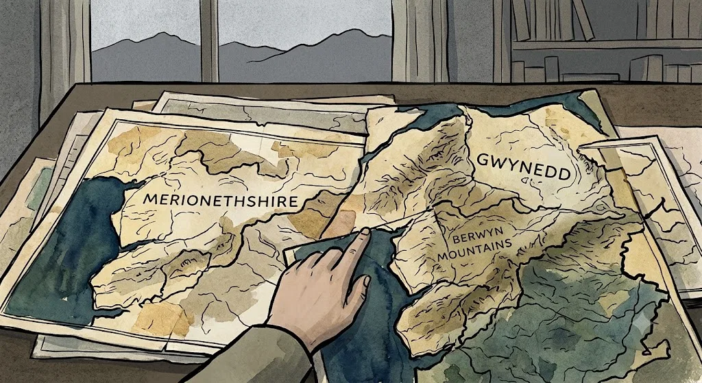
Historic Merionethshire, modern Gwynedd and nearby Denbighshire can blur where sightings and archives appear to belong.
On this page
- Historic Merionethshire versus modern labels
- Bala, Llandrillo and the Berwyn border problem
- How geography shapes UFO archives
Page outline Jump by section
Introduction
The Berwyn story belongs to historic Merionethshire, but it cannot be understood if it is forced into one neat county label. The famous events of 23 January 1974 were centred on the Bala, Llandrillo and Berwyn Mountains area: a loud bang, ground-shaking, reported lights, an emergency search and later claims of a crashed UFO. Yet the same places now appear in different administrative boxes. Bala sits in modern Gwynedd; Llandrillo is now in Denbighshire; the Berwyn range itself lies across old county edges and modern reporting habits often reduce the whole case to “North Wales”. [Encyclopedia Britannica+2Wikishire]britannica.comOpen source on britannica.com.
That boundary problem matters because UFO history is built from labels: police logs, newspaper datelines, Ministry of Defence files, local memories, later books and online databases. A reader searching only for “Gwynedd UFOs”, “Denbighshire UFOs” or “Merionethshire UFOs” can easily find different fragments of the same case, or miss why the case became a North Wales story rather than a single-village report.
Why Historic Merionethshire Still Matters
Historic Merionethshire was one of the old Welsh counties, running from Cardigan Bay inland through mountain country towards Bala and the Berwyns. Britannica describes Merioneth as a historic county of north-west Wales extending from the coast into Snowdonia and the Berwyn mountains, with most of the old county now in Gwynedd and its northern part in modern Denbighshire. [Encyclopedia Britannica]britannica.comOpen source on britannica.com.
That is the first key to the Berwyn case. The incident is often described as taking place at Llandrillo, historically in Merionethshire, while modern gazetteers and local-government references place Llandrillo in Denbighshire. Wikishire describes Llandrillo as a village and parish in the Edeirnion area of Merionethshire, on the Bala-to-Corwen road; other modern summaries describe the same village as a Denbighshire community, historically in Merionethshire. [Wikishire]wikishire.co.ukOpen source on wikishire.co.uk.
For a historic-county UFO project, the useful answer is not to choose one label and erase the others. The best practice is to state the frame plainly: this page treats the Berwyn incident as part of Merionethshire’s historic-county UFO history, while recognising that modern administrative records, press archives and public memory may file the same material under Gwynedd, Denbighshire, Clwyd or North Wales.
The project’s wider geographic index uses historic counties rather than modern council areas. That approach is supported by the historic-counties mapping tradition: Wikimedia Commons hosts a Wales historic counties map showing the thirteen Welsh historic counties as they existed until 1974, and the Wikishire-linked historic county map material is built around fixed historic county boundaries rather than current local-government units. [Wikimedia Commons]commons.wikimedia.orgCommons File:Wales Historic Counties map.svgCommons File:Wales Historic Counties map.svg

Bala, Llandrillo And The Berwyn Border Problem
The Berwyn story is geographically awkward because its strongest place names do different jobs. Bala gives the earthquake its usual scientific label: R. M. W. Musson’s study calls it the Bala earthquake of 23 January 1974 and gives the instrumental magnitude as 3.5 ML, with macroseismic estimates higher at about 3.9 to 4.0 ML. [NERC Open Research Archive]nora.nerc.ac.ukBala paper MussonBala paper Musson
Llandrillo gives the case its village-level witness setting. It is the place most often attached to reports of residents hearing the bang, feeling the tremor and assuming that an aircraft might have crashed in the mountains. GENUKI’s Merionethshire entry places Llandrillo in the hundred of Edeirnion, county Merioneth, five miles south-west of Corwen and seven miles north-east of Bala, which helps explain why older descriptions keep pulling the story back into Merionethshire even when modern maps say Denbighshire. [genuki.org.uk]genuki.org.ukOpen source on genuki.org.uk.
The Berwyn Mountains provide the dramatic landscape but also complicate the filing. Wikishire describes the Berwyn range as a sparsely populated moorland area in north-east Wales, on the boundaries of Merionethshire with Denbighshire and Montgomeryshire, roughly bounded by Llangollen, Corwen, Bala and Oswestry. [Wikishire]wikishire.co.ukBerwyn RangeBerwyn Range That means a single light seen “over the Berwyns” may be locally reported through several different mental maps.
A practical way to read the geography is this:
- Bala anchors the scientific and regional earthquake account.
- Llandrillo anchors the village witness and emergency-response account.
- Cadair Berwyn and the upland range anchor the later “crash site” tradition.
- North Wales anchors the press and Ministry of Defence framing, because the event quickly became wider than one historic county.
This is why the question “Where does the Berwyn story belong?” has more than one honest answer. In historic-county terms, it belongs strongly to Merionethshire. In modern administrative terms, parts of the same story appear under Gwynedd and Denbighshire. In UFO culture, it usually belongs to North Wales.
How The Boundary Shift Changes The Evidence Trail
County names matter most when a reader tries to verify the story. A modern search for “Merionethshire UFO” may lead to the historic framing; a search for “Denbighshire UFO Llandrillo” may lead to modern place labels; a search for “Bala earthquake” may lead to seismology rather than UFO literature; and a search for “Berwyn Mountain UFO” may lead to popular retellings, documentaries and conspiracy claims.
The official and technical trail does not sit neatly in one local box. Musson’s reconstruction records that police received numerous calls after the 8.38 pm earthquake, checked with RAF Valley on Anglesey and the Preston air traffic control centre, and treated the situation as a possible aircraft crash. Within about an hour, officers were searching the Berwyn Mountains where lights had been reported, and an RAF mountain rescue group later became involved. [NERC Open Research Archive]nora.nerc.ac.ukBala paper MussonBala paper Musson
That pattern is exactly what should be expected in a boundary-crossing upland incident. An apparent crash in darkness would not respect county lines. Reports could come from homes, roads and valleys on different sides of the hills. Police and RAF checks would follow operational geography, not antiquarian county geography. Later researchers then inherit a mixed paper trail: local memory from villages, newspaper coverage from the wider region, Ministry of Defence correspondence and scientific discussion of the earthquake.
The National Archives’ UFO briefing material also treats the case in wider institutional terms. Its 2012 briefing guide notes that AIR 2/19083 contains brief details of the so-called Berwyn Mountains UFO incident, reported in North Wales in January 1974, with further details released to a member of the public in 2003 in DEFE 24/2045/1. [National Archives]cdn.nationalarchives.gov.ukbriefing guide 12 07 12briefing guide 12 07 12 That wording is important: the archive label is not “Merionethshire UFO case” but “North Wales” and “Berwyn Mountains”.
Why “North Wales” Is Useful But Blunt
“North Wales” is a useful shorthand because the 1974 event was experienced and reported across a wide area. It captures the broad spread of calls, the regional press interest and the involvement of institutions beyond the old county. It also helps readers who have never heard of Merionethshire locate the story quickly.
But the shorthand is blunt. It can flatten a specific geography into a vague paranormal landscape. Bala, Llandrillo and the Berwyns are not interchangeable. The earthquake evidence is tied to the Bala area; the village reports cluster around places such as Llandrillo; the later crash narrative attaches itself to high ground in the Berwyn range. Treating all of that as simply “a North Wales UFO” makes the story easier to sell but harder to check.
This matters especially for the sceptical assessment. The strongest non-UFO explanation is not a generic dismissal but a place-specific reconstruction: a real earthquake in the Bala area, coinciding with a bright meteor or fireball seen more widely, plus local lights and the confusion of a night-time mountain search. Musson’s paper presents the earthquake as a significant North Wales event away from the better-known Caernarfon–Llŷn seismic area, while popular and local accounts preserve the witness experience of lights, rumbling and emergency concern. [NERC Open Research Archive]nora.nerc.ac.ukBala paper MussonBala paper Musson
A good county-level account should therefore use “North Wales” as a reporting frame, not as a substitute for local geography. The term explains why the case appears in regional media and national UFO files; it does not replace the need to identify where the historic Merionethshire elements lie.

How Modern Labels Can Create False Contradictions
Some apparent contradictions in Berwyn reporting are not contradictions in the event; they are contradictions in labelling. A reader may see Llandrillo described as Merionethshire in one source and Denbighshire in another and assume one is wrong. In fact, both can be correct if the source is using a different geographic frame.
The same issue affects the county identity of the Berwyn uplands. Wikishire’s historic-county description places the range on the boundaries of Merionethshire, Denbighshire and Montgomeryshire, while modern public descriptions often use Denbighshire, Gwynedd or simply North Wales. [Wikishire]wikishire.co.ukBerwyn RangeBerwyn Range For UFO reporting, that means a sighting may be geographically stable while its label changes over time.
This is a common problem in British UFO archives. Ministry of Defence files, local newspapers and later researchers often sort sightings by the administrative vocabulary of their own period. A 1974 local report, a 1990s retelling and a 2010s declassified-file article may all describe the same underlying event, but the county names around it may reflect different mapping habits.
For Merionethshire, the safest wording is usually:
“Historic Merionethshire, near the modern Gwynedd–Denbighshire administrative pattern, in the Bala–Llandrillo–Berwyn area of North Wales.”
That phrasing is not elegant, but it prevents the two common mistakes: treating modern Denbighshire labels as if they erase Merionethshire, or treating the historic county as if modern records must use its name.
What The Boundary Problem Does Not Prove
Boundary confusion does not strengthen the UFO-crash claim by itself. It explains why records and retellings are scattered, but it does not create evidence of wreckage, bodies, a hidden recovery operation or an extraterrestrial craft.
The strongest documented facts remain more modest. There was a real seismic event; people reported lights and sounds; police and rescue services acted as though an aircraft crash was possible; searches found no crashed aircraft or confirmed object. Musson’s study supports the earthquake component, and later file releases and press reports show that the Ministry of Defence and National Archives material treated the matter as a reported North Wales UFO incident rather than proof of a recovered craft. [NERC Open Research Archive+2The Guardian]nora.nerc.ac.ukBala paper MussonBala paper Musson
At the same time, boundary clarity should not be used to belittle witnesses. For people in and around Llandrillo and Bala, the experience was immediate: a bang, shaking ground, lights, fear of a crash and visible emergency activity. Those ingredients are enough to explain why the story lasted. They are also enough to explain why later retellings could grow more elaborate, especially once the case acquired the “Welsh Roswell” nickname in popular coverage. [Sky HISTORY TV channel]history.co.ukberwyn mountain ufo the welsh roswellberwyn mountain ufo the welsh roswell
The boundary issue therefore changes how the case should be filed and read, not the evidential standard. It helps explain archive fragmentation and regional identity. It does not turn a weakly supported crash narrative into a confirmed event.
A Better Way To File The Berwyn Case
For this project, the Berwyn case should be indexed under historic Merionethshire because the Bala–Llandrillo setting sits naturally within the county’s historic geography and because Llandrillo’s older county identity is Merionethshire. It should also be cross-referenced to Denbighshire, Gwynedd and wider North Wales reporting because modern readers and modern archives often encounter the story through those labels. [Wikishire+2Wikipedia]wikishire.co.ukOpen source on wikishire.co.uk.
The practical filing model is:
- Primary historic-county home: Merionethshire.
- Modern administrative cross-reference: Gwynedd for Bala-area context and Denbighshire for present-day Llandrillo labelling.
- Regional reporting frame: North Wales, especially for press, Ministry of Defence and National Archives references.
- Neighbouring historic-county relevance: Denbighshire and Montgomeryshire where the Berwyn range and witness geography cross old borders.
- Case classification: unresolved as a witness story in some details, but strongly explained in its core physical triggers by earthquake, meteor/fireball reports and local search confusion.
This keeps the page honest. It allows Merionethshire to remain the centre of gravity without pretending the case was sealed inside one county line. It also helps readers follow the evidence from local place names to national records without losing sight of the historic county that gives this branch its structure.

What Readers Should Take Away
The Berwyn story belongs to Merionethshire in the historic-county sense, but it became famous because it crossed boundaries in practice. The same night involved Bala, Llandrillo, the Berwyn uplands, police searches, RAF checks, regional newspapers, Ministry of Defence correspondence and later UFO culture. That is why it appears under several labels and why arguments over place names can obscure the simpler evidential picture.
The most reliable reading is geographical rather than sensational. County boundaries explain why the archive trail is messy. They explain why one person calls it a Merionethshire case, another a Denbighshire case and another a North Wales mystery. They do not by themselves explain the lights or prove a crash. For that, the strongest available evidence still points to a real earthquake near Bala, widely reported lights consistent with a meteor or fireball, and a reasonable emergency response in difficult mountain terrain.
eBay marketplace picks
Marketplace Samples
Example marketplace items related to this page. Use the search link to explore similar finds on eBay.


Endnotes
-
Source: britannica.com
Link: https://www.britannica.com/place/Merioneth -
Source: Wikipedia
Title: Llandrillo, Denbighshire
Link: https://en.wikipedia.org/wiki/Llandrillo%2C_Denbighshire -
Source: commons.wikimedia.org
Title: Commons File:Wales Historic Counties map.svg
Link: https://commons.wikimedia.org/wiki/File%3AWales_Historic_Counties_map.svg -
Source: genuki.org.uk
Link: https://www.genuki.org.uk/big/wal/MER/Llandrillo -
Source: Wikipedia
Title: Berwyn Mountain UFO incident
Link: https://en.wikipedia.org/wiki/Berwyn_Mountain_UFO_incident -
Source: Wikipedia
Link: https://en.wikipedia.org/wiki/Merionethshire -
Source: Wikipedia
Title: Historic counties of Wales
Link: https://en.wikipedia.org/wiki/Historic_counties_of_Wales -
Source: Wikipedia
Title: File:Northern England Historic counties.svg
Link: https://en.wikipedia.org/wiki/File%3ANorthern_England-Historic_counties.svg -
Source: Wikipedia
Title: Historic counties of England
Link: https://en.wikipedia.org/wiki/Historic_counties_of_England -
Source: commons.wikimedia.org
Title: File:Wales Historic Counties map Denbighshire.svg
Link: https://commons.wikimedia.org/wiki/File%3AWales_Historic_Counties_map_Denbighshire.svg -
Source: commons.wikimedia.org
Title: Category:Llandrillo, Denbighshire
Link: https://commons.wikimedia.org/wiki/Category%3ALlandrillo%2C_Denbighshire -
Source: commons.wikimedia.org
Link: https://commons.wikimedia.org/wiki/File%3ABritish_Isles_map_showing_UK%2C_Republic_of_Ireland%2C_and_historic_counties.svg -
Source: commons.wikimedia.org
Title: Category:Maps of counties of England
Link: https://commons.wikimedia.org/wiki/Category%3AMaps_of_counties_of_England -
Source: commons.wikimedia.org
Title: File:English counties 1851 with ridings.svg
Link: https://commons.wikimedia.org/wiki/File%3AEnglish_counties_1851_with_ridings.svg -
Source: commons.wikimedia.org
Title: File:English counties 1851 (numbered).svg
Link: https://commons.wikimedia.org/wiki/File%3AEnglish_counties_1851_%28numbered%29.svg -
Source: commons.wikimedia.org
Title: File:Historic counties of the United Kingdom.svg
Link: https://commons.wikimedia.org/wiki/File%3AHistoric_counties_of_the_United_Kingdom.svg -
Source: commons.wikimedia.org
Title: File:English ceremonial counties 2010.svg
Link: https://commons.wikimedia.org/wiki/File%3AEnglish_ceremonial_counties_2010.svg -
Source: genuki.org.uk
Link: https://www.genuki.org.uk/big/wal/MER/Llandrillo/Gaz1868 -
Source: britannica.com
Link: https://www.britannica.com/place/Denbighshire-county-Wales -
Source: wikishire.co.uk
Link: https://wikishire.co.uk/wiki/Llandrillo -
Source: wikishire.co.uk
Title: Berwyn Range
Link: https://wikishire.co.uk/wiki/Berwyn_Range -
Source: wikishire.co.uk
Title: Wikishire Great Britain and Ireland
Link: https://wikishire.co.uk/map/ -
Source: nora.nerc.ac.uk
Title: Bala paper Musson
Link: https://nora.nerc.ac.uk/id/eprint/1531/1/Bala_paper_Musson.pdf -
Source: cdn.nationalarchives.gov.uk
Title: briefing guide 12 07 12
Link: https://cdn.nationalarchives.gov.uk/documents/briefing-guide-12-07-12.pdf -
Source: datamap.gov.wales
Title: Historic County Boundaries of Wales
Link: https://datamap.gov.wales/layers/geonode%3Ahistoric_counties_bng_rcahmw_ply -
Source: theguardian.com
Title: ufo files welsh roswell national archive
Link: https://www.theguardian.com/world/2010/aug/05/ufo-files-welsh-roswell-national-archive -
Source: history.co.uk
Title: berwyn mountain ufo the welsh roswell
Link: https://www.history.co.uk/articles/berwyn-mountain-ufo-the-welsh-roswell -
Source: discovery.nationalarchives.gov.uk
Link: https://discovery.nationalarchives.gov.uk/details/a?_ref=220 -
Source: cdn.nationalarchives.gov.uk
Link: https://cdn.nationalarchives.gov.uk/documents/the-ufo-files-extract.pdf -
Source: wikishire.co.uk
Link: https://wikishire.co.uk/wiki/Denbighshire -
Source: wikishire.co.uk
Link: https://wikishire.co.uk/wiki/Merionethshire -
Source: wikishire.co.uk
Title: Historic Counties Standard
Link: https://wikishire.co.uk/wiki/Historic_Counties_Standard -
Source: wikishire.co.uk
Title: unties of the United Kingdom
Link: https://wikishire.co.uk/wiki/Counties_of_the_United_Kingdom -
Source: assets.publishing.service.gov.uk
Link: https://assets.publishing.service.gov.uk/media/5a7988ebe5274a684690a486/reqjan11_2.csv -
Source: en.wikisource.org
Link: https://en.wikisource.org/wiki/1911_Encyclop%C3%A6dia_Britannica/Merioneth
Additional References
-
Source: youtube.com
Link: http://www.youtube.com/watch?v=ECE5660aeZoSource snippet
Berwyn Mountain UFO incident 1974 documentary UFO Documentary 2015 UFO Encounters Berwyn Mountain Mystery New Ufo documentary documentary...
-
Source: youtube.com
Title: The Berwyn Mountains “Welsh Roswell” UFO incident,
Link: http://www.youtube.com/watch?v=jLwzZdJKW0oSource snippet
‘The Welsh Roswell’ - the Berwyn mountain UFO crash, Llandrillo, Wales, January 23, 1974...
Published: January 23, 1974
-
Source: youtube.com
Title: ‘The Welsh Roswell’
Link: http://www.youtube.com/watch?v=hxo65ym4dogSource snippet
What crash landed in the Berwyn mountains?...
Published: January 23, 1974
-
Source: youtube.com
Link: http://www.youtube.com/watch?v=3sjkImmziEsSource snippet
UFO Documentary 2015 UFO Encounters Berwyn Mountain Mystery...
-
Source: gazetteer.org.uk
Link: https://gazetteer.org.uk/place/Bala%2C_Merionethshire_2001 -
Source: wikitree.com
Link: https://www.wikitree.com/wiki/Category%3ABala%2C_Merionethshire -
Source: realcounties.com
Link: https://realcounties.com/counties-of-wales/ -
Source: library.wales
Link: https://www.library.wales/discover-learn/digital-exhibitions/maps/county-maps -
Source: mythslegendsodditiesnorth-east-wales.co.uk
Link: https://www.mythslegendsodditiesnorth-east-wales.co.uk/berwyn-ufo-incident -
Source: abcounties.com
Link: https://abcounties.com/counties/county-profiles/denbighshire/
Topic Tree